


Gigantic wildfires in France’s Gironde region and near Madrid, Spain, have devastated tens of thousands of hectares of vegetation.
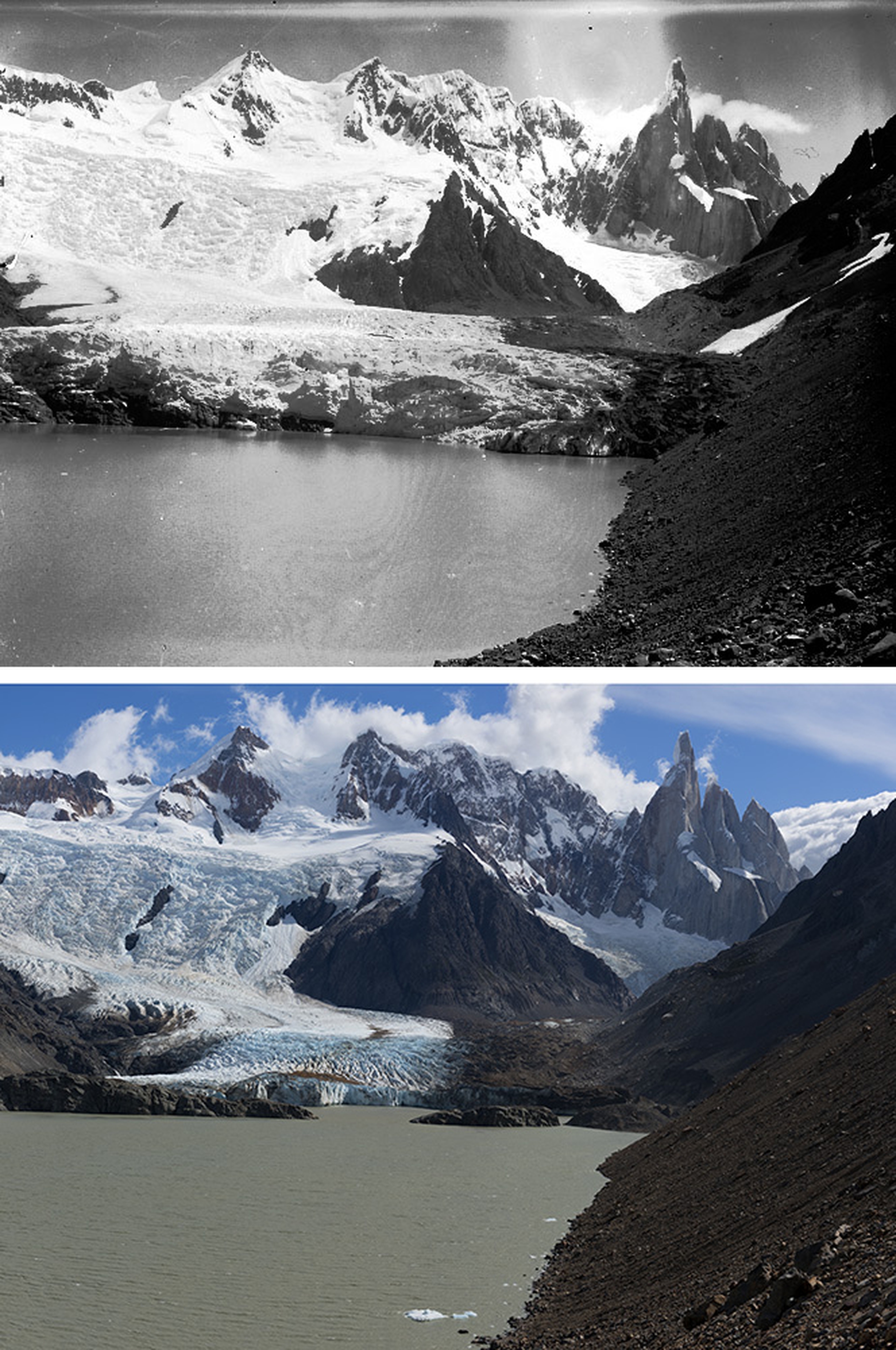
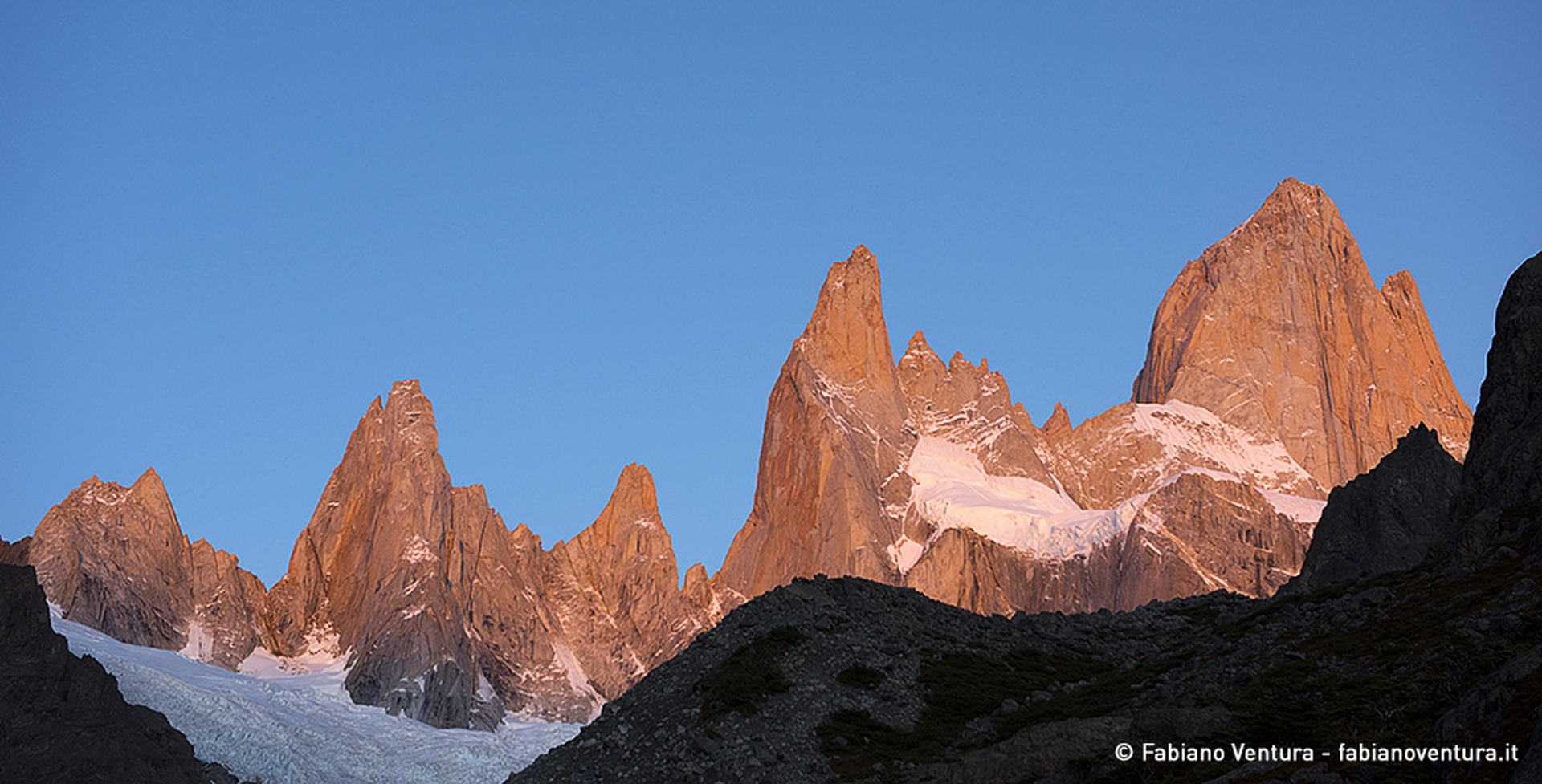
Fitz Roy is a mountain in Patagonia, on the border between Argentina and Chile. It is part of Los Glaciares National Park in Argentina and Bernardo O’Higging National Park in Chile. Its peak is 3,405 metres above sea level. Cerro Torre is an Argentinian mountain, also found in Patagonia, west of Fitz Roy, and is
Fitz Roy is a mountain in Patagonia, on the border between Argentina and Chile. It is part of Los Glaciares National Park in Argentina and Bernardo O’Higging National Park in Chile. Its peak is 3,405 metres above sea level. Cerro Torre is an Argentinian mountain, also found in Patagonia, west of Fitz Roy, and is 3,128 metres high.
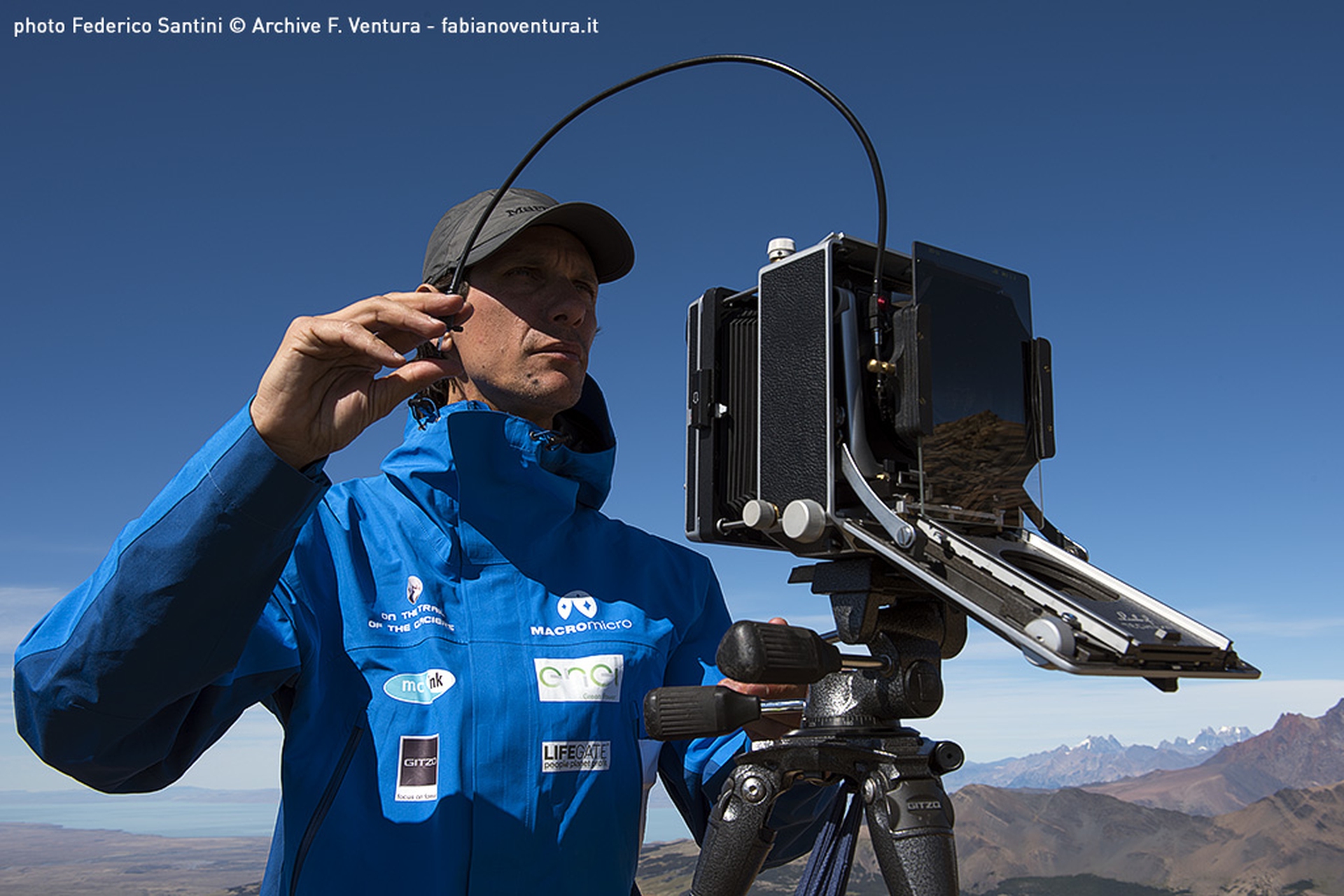
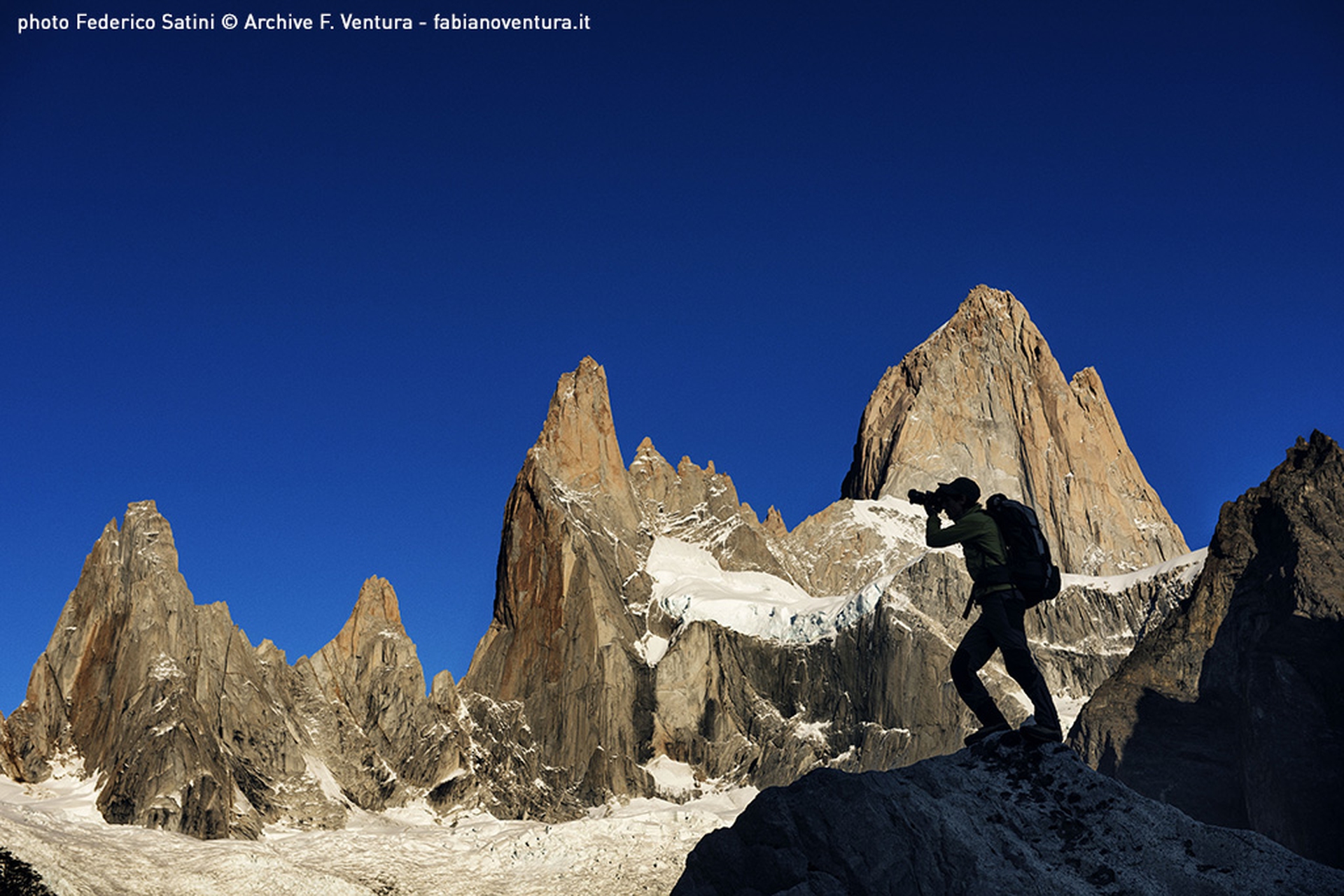
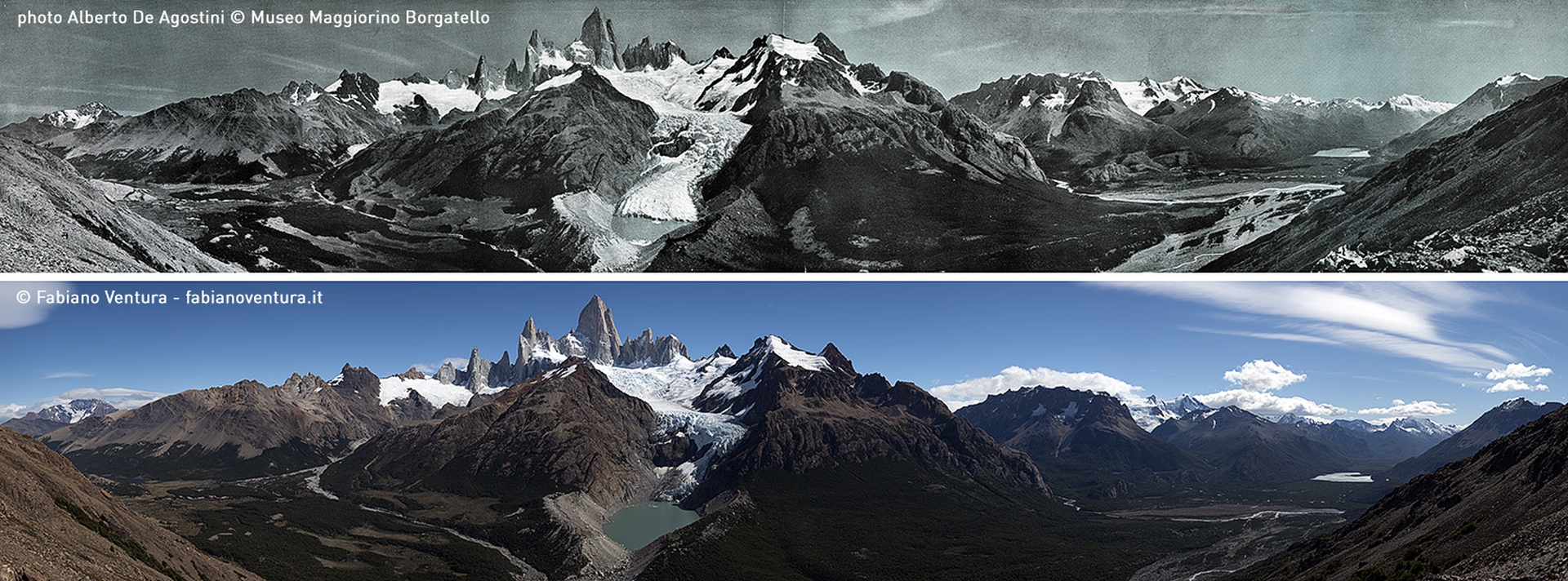
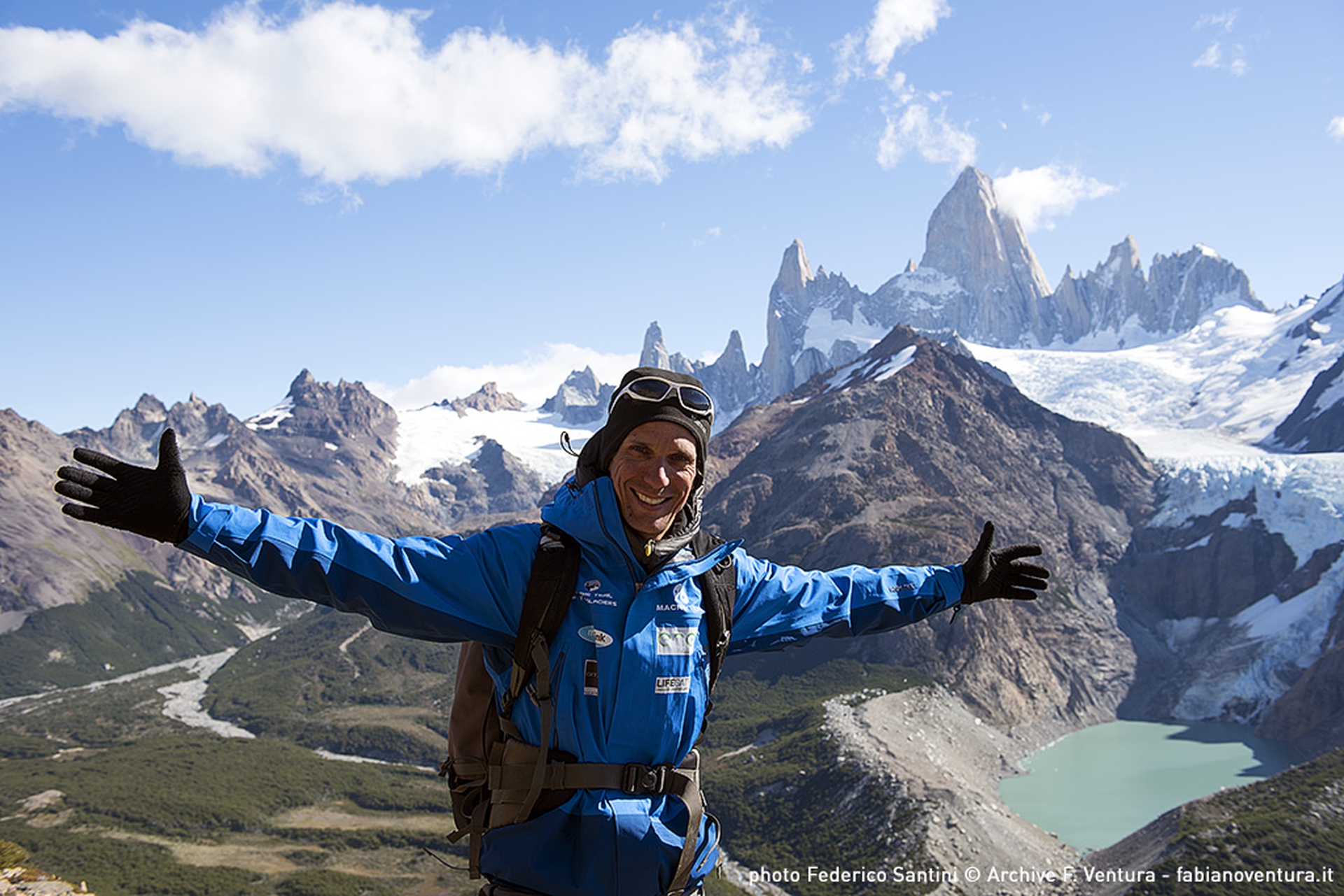
Fabiano Ventura, who launched the photographic and scientific project On the Trails of the Glaciers, defined these mountains as the world’s most extreme. The fourth edition of the project took place in the Tierra del Fuego and the Patagonian Andes. It drew to a close, achieving significant results, on the 9th of April. From the 12th to the 16th of March Ventura documented the conservation status of these two incredible peaks, helped by park keepers who transported his technical equipment. National parks played a crucial role: their representatives shared Ventura’s objective and desire to document how mountains have changed over the years.
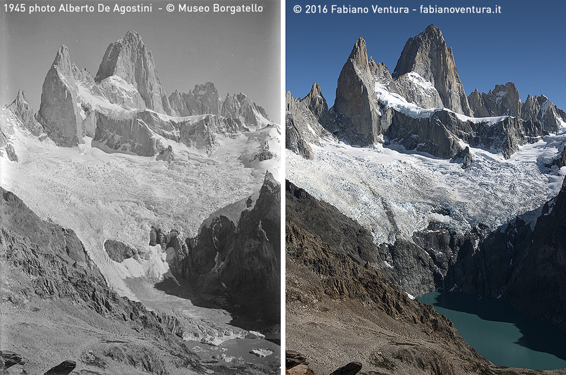
The expedition’s first photographic objective was to shoot the summit of Cerro Polo, where Ventura reproduced the exact panoramic view captured by explorer and priest Alberto Maria De Agostini, who photographed Fitz Roy from a favourable, frontal angle. With historic photos at hands, Ventura managed to find the exact point thanks to the presence of rocks: “I assembled my Linhof and started shooting right away. Fitz Roy can be covered with clouds in an instant”.
Differences with the historical pictures are clear. Today, the front of Blanco glacier has retreated hundreds of metres. Years ago it covered half the lagoon, which has now turned into a huge rocky mountain wall.
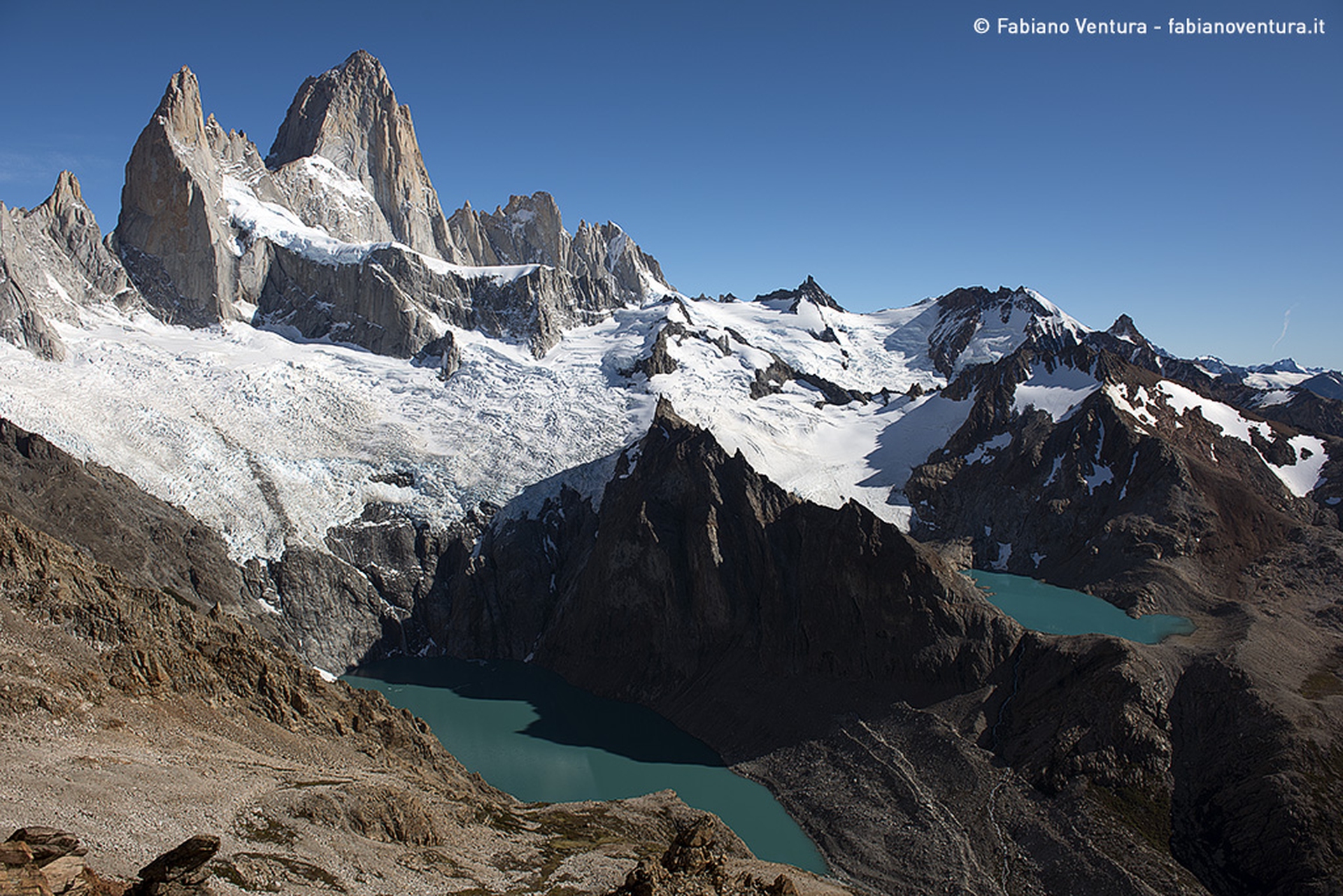
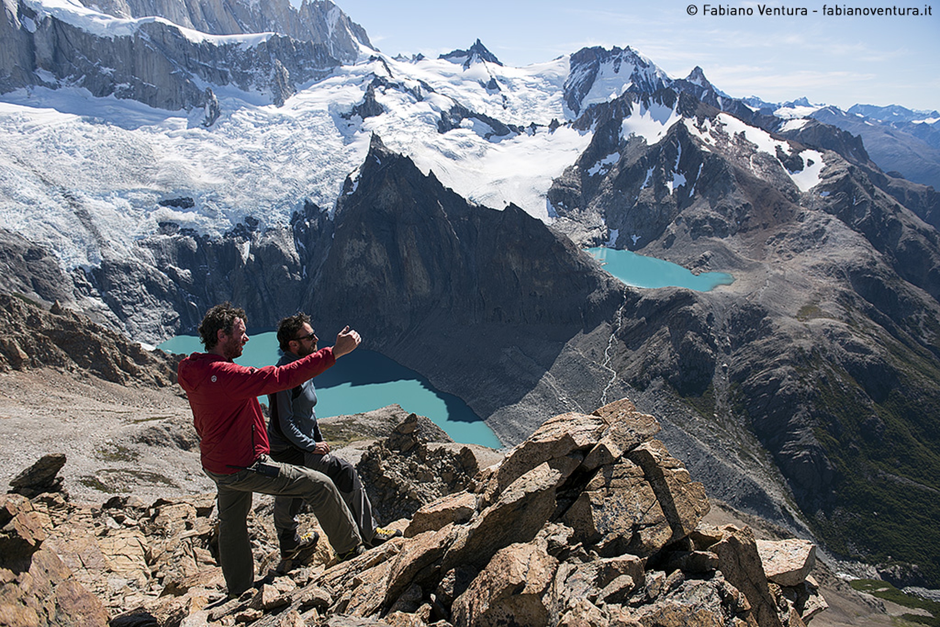
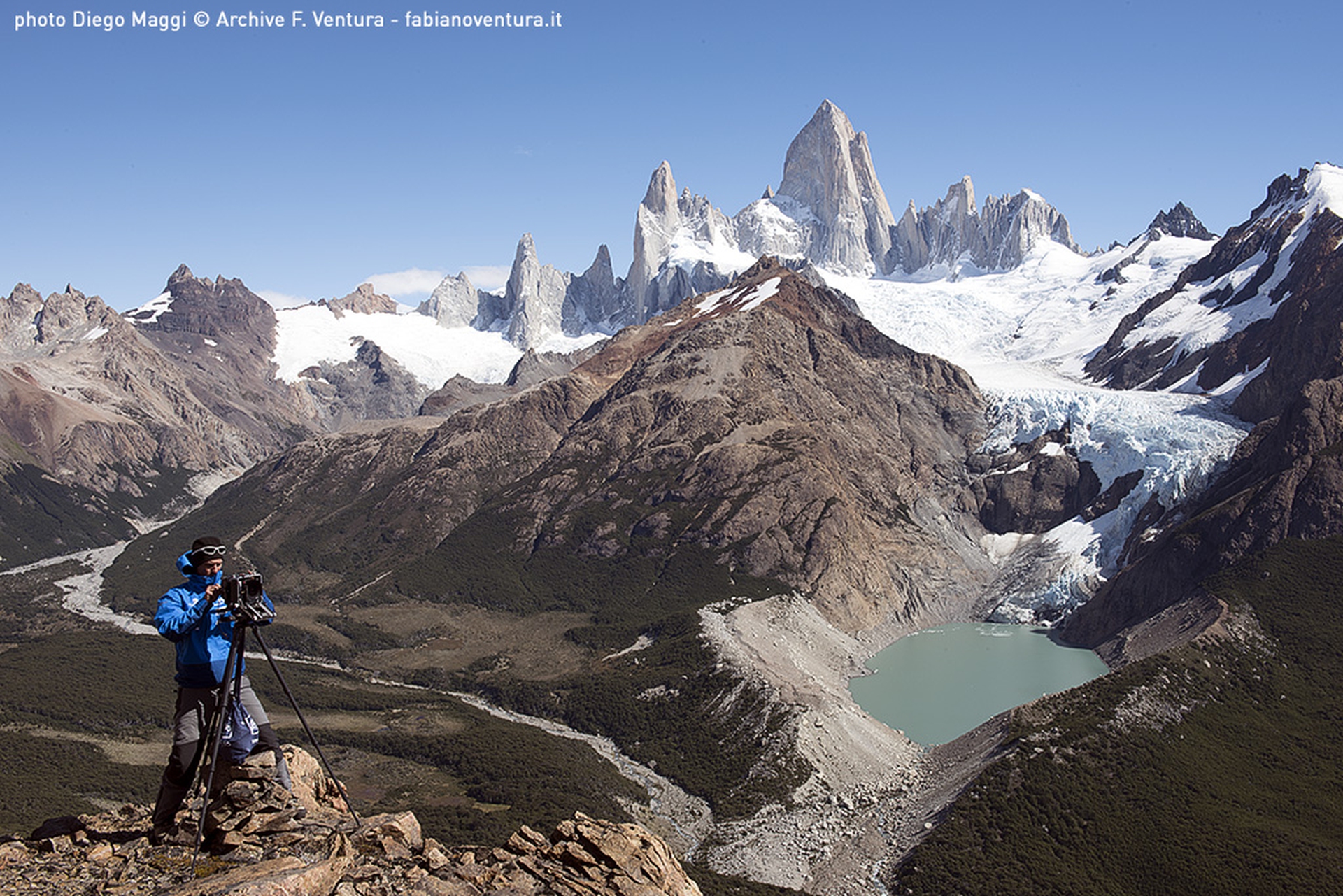
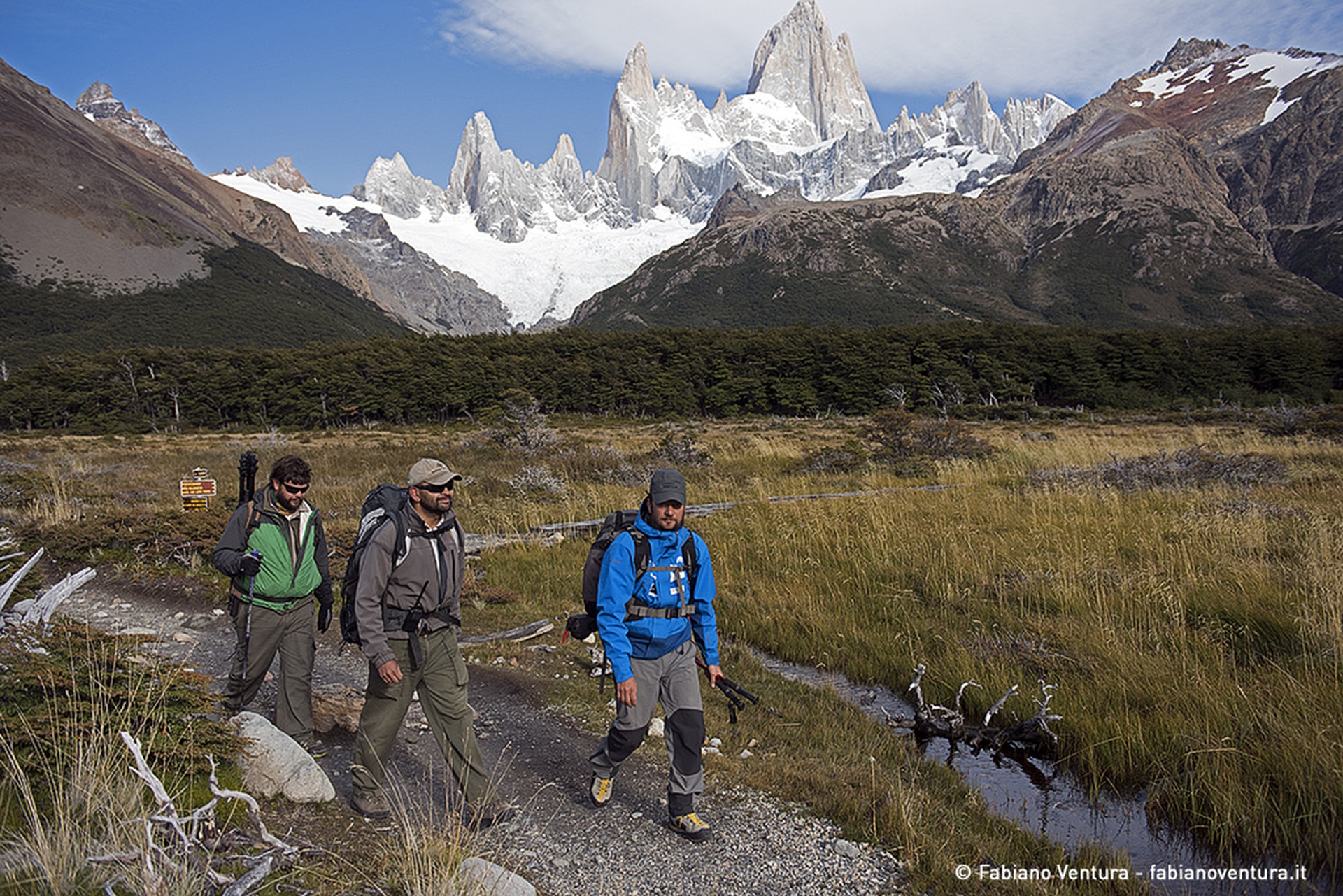
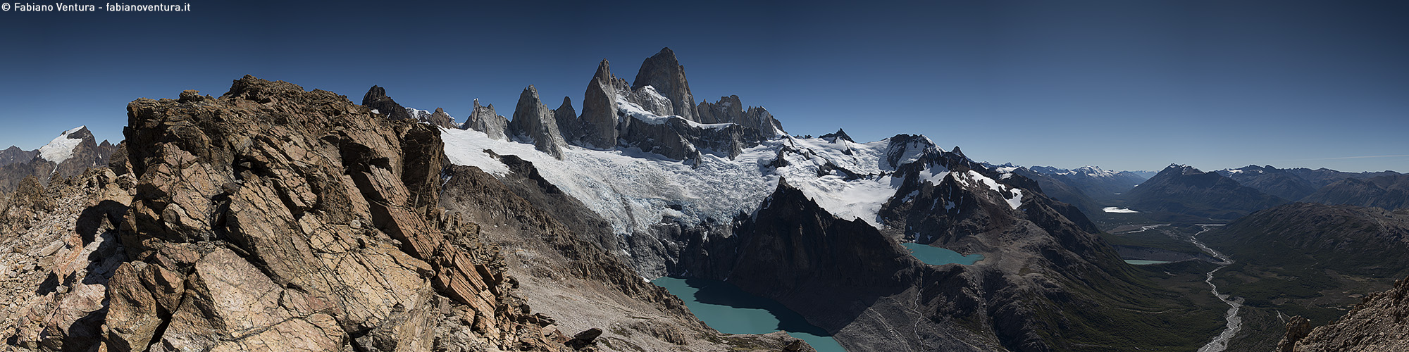
Second stop: Loma de las Pizarras. After a steep, arduous route Ventura managed to take pictures of Fitz Roy’s granitic peaks with their blue-green glacial lakes as well the Argentinian desert together with Viedma Lake. He also took a shot outside of the scope of De Agostini’s collection: a 360-degree panoramic view.
The last route was along the Laguna Madre valley and the enchanted Lenga forest, which leads to the Mirador Maestri, where Ventura managed to capture a breathtaking view of Cerro Torre. In these pictures Ventura noticed how “the Torre Glacier has retreated at least 50 metres”. The differences with De Agostini’s pictures, taken in 1945, are huge.
[vimeo url=”https://vimeo.com/162155864″]
The expedition succeeded in showing the effects of global warming on glaciers. Over the course of three day, the team covered 60 kilometres, 4,000 metres in altitude and took five photos from the very points De Agostini shot his pictures 70 years ago. This part of the expedition was hard but meaningful for this edition of On the Trails of the Glaciers and, most of all, the need to capture one of the biggest threats of our time: climate change.
Siamo anche su WhatsApp. Segui il canale ufficiale LifeGate per restare aggiornata, aggiornato sulle ultime notizie e sulle nostre attività.
![]()
Quest'opera è distribuita con Licenza Creative Commons Attribuzione - Non commerciale - Non opere derivate 4.0 Internazionale.
Gigantic wildfires in France’s Gironde region and near Madrid, Spain, have devastated tens of thousands of hectares of vegetation.
According to analysts, the emergence of a “super” El Niño could trigger a global food price shock, adding to inflationary pressures already fuelled by the conflict with Iran.
Residents of Kanseche, Malawi, accuse ABF of contributing to the devastating 2022 floods through its subsidiary, Illovo Sugar.
France, Spain, Portugal and Greece are fighting wildfires, some of which are still out of control.
Much of Western Europe is already dealing with temperatures that in many cities are approaching or exceeding 35°C.
After a landslide led to twelve deaths on the island of Ischia, questions have been raised about the impacts of illegal building, tourism, and climate change.
Not much snow, peaks of 19 degrees Celsius in Norway and even 28 degrees in France: official data confirms the anomalously high temperatures of this past winter.
Ocean warming has risen to record highs over the last five years: just in 2019 the heat released into the world’s oceans was equivalent to that of 5-6 atomic bombs per second. The culprit, no doubt, is climate change.
What did Greta Thunberg tell participants at the 2020 World Economic Forum in Davos? Once again, the Swedish activist underlined the total lack of concrete solutions to the climate crisis presented by leaders so far.


